Extent beneath land and sea
The plate includes much of North America, Greenland and adjacent ocean floor. Its eastern edge is offshore at spreading ridges, rather than along the Atlantic coast.
Trace the North American Plate from the continent into the Atlantic and Arctic oceans.
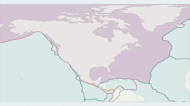
The plate includes much of North America, Greenland and adjacent ocean floor. Its eastern edge is offshore at spreading ridges, rather than along the Atlantic coast.
The Mid-Atlantic Ridge is a divergent eastern boundary. Western North America includes transform motion in California and subduction at Cascadia and Alaska, with regional complexity between them.
Political North America and the North American Plate are different areas. Parts of western California sit on the Pacific side of the main boundary, while Greenland lies on the North American Plate.
Plate outlines use Peter Bird's PB2002 model, distributed by Nordpil under the Open Data Commons Attribution licence. Coastlines and country outlines are Natural Earth public-domain data. Boundary detail is limited by the source model.
Country lookup compares simplified land outlines with the plate model. Boundaries and historical coastlines are modelled features. This atlas explains geography; it does not predict earthquakes or provide site-specific hazard estimates.