Choose a geological time
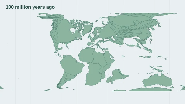
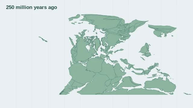
Geological ages are often given in Ma, meaning millions of years before the present. Always connect a reconstructed position with its displayed time and model. Choose one of six snapshots from the present to 250 million years ago. The display rotates modern coastline outlines with the MULLER2019 model; it does not reconstruct ancient shorelines or country borders.
Continents through time
Continents change position, but their coastlines also change as seas rise, basins form and mountains erode. Moving today's land outlines alone does not reproduce ancient geography.
How reconstructions are modelled
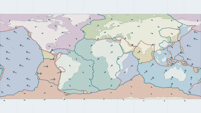
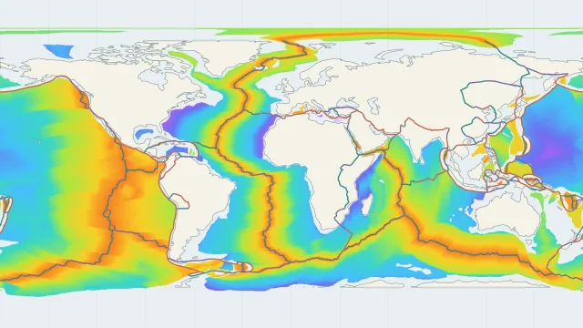
Reconstructions combine evidence such as magnetic patterns, rock relationships and fossils with plate rotations. Older ocean floor has often been subducted, leaving less direct evidence for earlier configurations.
Sources and map method
EarthByte / GPlates MULLER2019 reconstructions, mantle reference frame, CC BY 4.0. Six discrete snapshots rotate modern coastline outlines. They are not reconstructions of ancient shorelines.
Country lookup compares simplified land outlines with the plate model. Boundaries and historical coastlines are modelled features. This atlas explains geography; it does not predict earthquakes or provide site-specific hazard estimates.