The San Andreas Fault system
The San Andreas accommodates a major share of sideways motion between the Pacific and North American plates. It is one part of a broad system, with multiple branches and neighbouring faults.
Locate California's mapped faults and compare them with the Pacific-North American boundary.
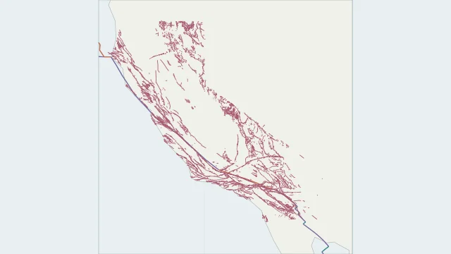
The San Andreas accommodates a major share of sideways motion between the Pacific and North American plates. It is one part of a broad system, with multiple branches and neighbouring faults.
The detailed layer uses the California part of the USGS Quaternary Fault and Fold Database, 2020 release. Click a trace for its recorded age and location certainty. It includes several Quaternary age classes, not only currently active faults; the separate offshore layer is not included.
A world plate boundary is a simplified regional line. A fault trace shows where a particular fault intersects or approaches the surface; neither is a forecast of the next rupture.
Plate outlines use Peter Bird's PB2002 model, distributed by Nordpil under the Open Data Commons Attribution licence. Coastlines and country outlines are Natural Earth public-domain data. Boundary detail is limited by the source model. Terrain uses the Natural Earth I shaded-relief raster, public domain. Its global scale does not resolve individual faults or local elevation. Detailed California traces use the USGS Quaternary Fault and Fold Database, 2020 release. The separate offshore layer is omitted.
Country lookup compares simplified land outlines with the plate model. Boundaries and historical coastlines are modelled features. This atlas explains geography; it does not predict earthquakes or provide site-specific hazard estimates.