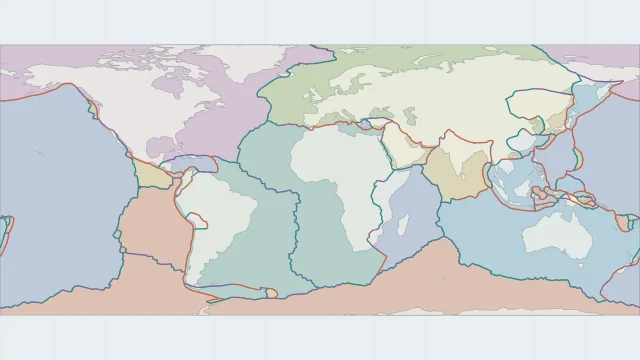
Download a labelled plate map
A labelled map works as a reference for names and outlines. Keep its legend and model credit with the image so the meaning of colours and lines remains clear.
Prepare a labelled reference map or a blank sheet for practising plate names.
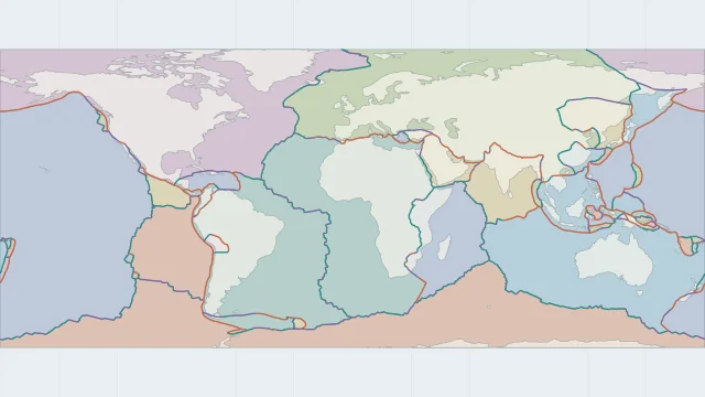
READY TO PRINT
Landscape PDFs include the map source. Use the labelled version as an answer key for the blank map.
A labelled map works as a reference for names and outlines. Keep its legend and model credit with the image so the meaning of colours and lines remains clear.
A blank map is useful for identifying plates from their shapes and neighbours. Begin with the largest regions, then work through the smaller oceanic and boundary-zone plates.
Use the paper size indicated by the file and check the preview for clipped labels. Compare answers with the matching labelled edition, since different models divide some plate regions differently.
Plate outlines use Peter Bird's PB2002 model, distributed by Nordpil under the Open Data Commons Attribution licence. Coastlines and country outlines are Natural Earth public-domain data. Boundary detail is limited by the source model.
Country lookup compares simplified land outlines with the plate model. Boundaries and historical coastlines are modelled features. This atlas explains geography; it does not predict earthquakes or provide site-specific hazard estimates.