Why the plate crosses the map edge
A rectangular world map cuts the globe at a chosen longitude. The Pacific Plate can appear on both sides of that cut even though the plate itself is continuous.
Follow the Pacific Plate across the ocean and compare its contrasting edges.
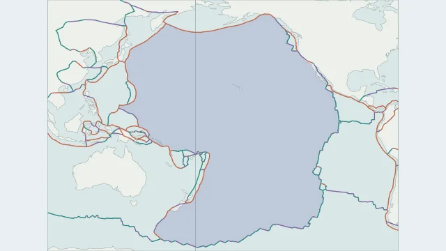
A rectangular world map cuts the globe at a chosen longitude. The Pacific Plate can appear on both sides of that cut even though the plate itself is continuous.
Spreading occurs along parts of its eastern and southern margins, while subduction and transform motion shape other edges. The whole perimeter therefore cannot be assigned a single boundary type.
Hawaii is within the Pacific Plate. New Zealand crosses its boundary with the Australian Plate. Country names alone are insufficient for assigning every island or territory to one plate.
Plate outlines use Peter Bird's PB2002 model, distributed by Nordpil under the Open Data Commons Attribution licence. Coastlines and country outlines are Natural Earth public-domain data. Boundary detail is limited by the source model.
Country lookup compares simplified land outlines with the plate model. Boundaries and historical coastlines are modelled features. This atlas explains geography; it does not predict earthquakes or provide site-specific hazard estimates.