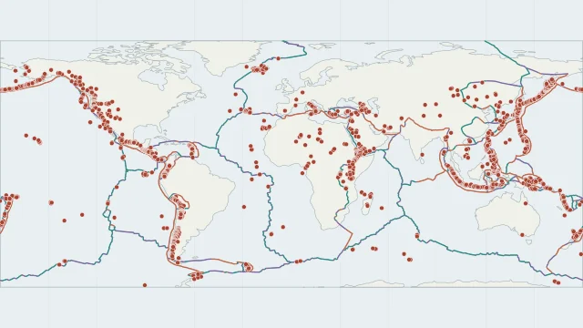
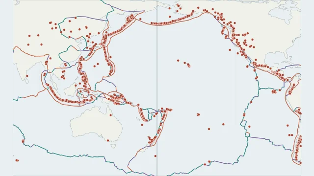
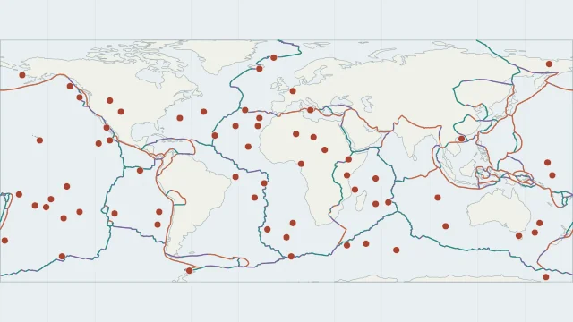
Earthquakes along plate boundaries
Earthquakes outline many ridges, trenches and transform systems. Their locations show where slip has occurred during the selected catalogue period, not where every future earthquake will occur.
Compare recorded earthquake locations with plate boundaries, magnitude and depth.
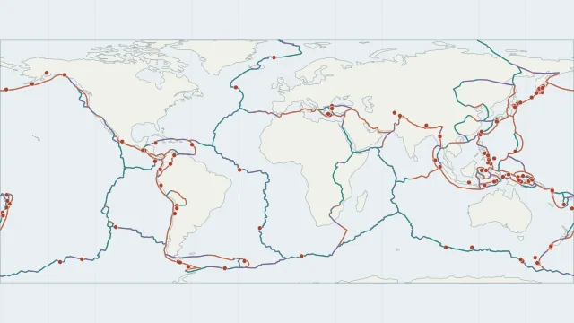
Earthquakes outline many ridges, trenches and transform systems. Their locations show where slip has occurred during the selected catalogue period, not where every future earthquake will occur.
Magnitude describes earthquake size; depth describes how far below the surface rupture began. Changing either threshold changes the visible pattern. The atlas earthquake snapshot covers calendar 2025 at magnitude 6 and above. The optional recent feed covers the latest seven days and includes smaller events; its completeness varies by region.
Earthquakes also occur away from plate edges, including within stable continental regions. Sparse dots in a short catalogue window do not mean a place has no earthquake hazard.
The default is a 2025 catalogue snapshot at magnitude 6 and above. Choose Latest 7 days for the recent USGS feed; its update time appears beside the results. Use Refresh events to fetch a new copy.
No. An epicentre marks the surface position above where rupture began. A large earthquake can rupture a much larger fault area.
Plate outlines use Peter Bird's PB2002 model, distributed by Nordpil under the Open Data Commons Attribution licence. Coastlines and country outlines are Natural Earth public-domain data. Boundary detail is limited by the source model.
Country lookup compares simplified land outlines with the plate model. Boundaries and historical coastlines are modelled features. This atlas explains geography; it does not predict earthquakes or provide site-specific hazard estimates.