Juan de Fuca Plate location
The Juan de Fuca Plate lies offshore from the Pacific Northwest, between the Pacific and North American plates. Most of its surface is beneath the ocean.
Compare the Juan de Fuca spreading ridge with the Cascadia subduction margin.
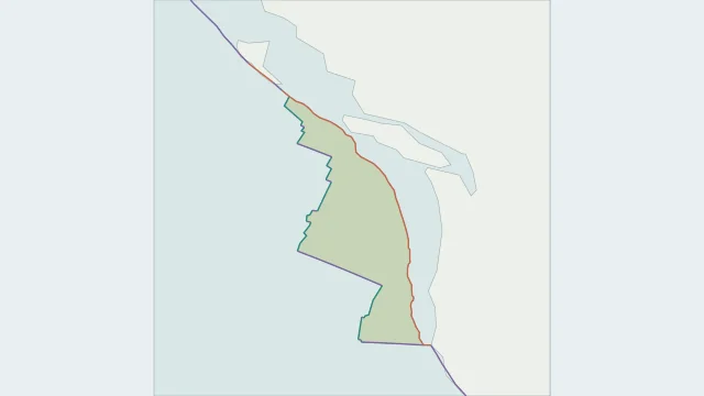
The Juan de Fuca Plate lies offshore from the Pacific Northwest, between the Pacific and North American plates. Most of its surface is beneath the ocean.
At Cascadia, oceanic lithosphere descends beneath North America. This subduction system is linked to the Cascade volcanic arc inland from the coast.
Regional maps distinguish Explorer to the north and Gorda to the south. Global models may group parts of this system differently, so compare their labels before matching outlines.
Plate outlines use Peter Bird's PB2002 model, distributed by Nordpil under the Open Data Commons Attribution licence. Coastlines and country outlines are Natural Earth public-domain data. Boundary detail is limited by the source model.
Country lookup compares simplified land outlines with the plate model. Boundaries and historical coastlines are modelled features. This atlas explains geography; it does not predict earthquakes or provide site-specific hazard estimates.