The Eurasian Plate outline
The Eurasian Plate underlies much of Europe and Asia and continues into neighbouring ocean basins. Its outline is geological and does not follow the Europe-Asia cultural boundary.
Explore Eurasia and the smaller plate regions around its southern and eastern margins.
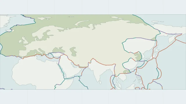
The Eurasian Plate underlies much of Europe and Asia and continues into neighbouring ocean basins. Its outline is geological and does not follow the Europe-Asia cultural boundary.
India converges with Eurasia at the Himalayas, while Arabia converges along the Zagros region. The Mediterranean also contains smaller blocks and multiple styles of deformation.
Asia includes the Indian, Arabian and Philippine Sea plate regions alongside Eurasia. PB2002 further separates blocks such as Amur and Sunda, which simplified world maps may group differently.
Plate outlines use Peter Bird's PB2002 model, distributed by Nordpil under the Open Data Commons Attribution licence. Coastlines and country outlines are Natural Earth public-domain data. Boundary detail is limited by the source model.
Country lookup compares simplified land outlines with the plate model. Boundaries and historical coastlines are modelled features. This atlas explains geography; it does not predict earthquakes or provide site-specific hazard estimates.