Europe on the Eurasian Plate
Much of Europe lies within the Eurasian Plate. Political or cultural boundaries inside Europe do not mark plate boundaries, and the plate continues eastward into Asia.
Compare Europe's broad Eurasian interior with its Atlantic and Mediterranean plate margins.
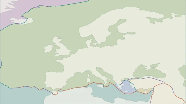
Much of Europe lies within the Eurasian Plate. Political or cultural boundaries inside Europe do not mark plate boundaries, and the plate continues eastward into Asia.
The Mediterranean is a wide zone of interaction involving Africa, Eurasia and smaller blocks. Subduction, extension and sideways faulting occur in different parts of that zone.
Iceland sits at the North American-Eurasian spreading boundary. It provides a contrasting northern example to the convergent and deforming margins around southern Europe.
Plate outlines use Peter Bird's PB2002 model, distributed by Nordpil under the Open Data Commons Attribution licence. Coastlines and country outlines are Natural Earth public-domain data. Boundary detail is limited by the source model. Terrain uses the Natural Earth I shaded-relief raster, public domain. Its global scale does not resolve individual faults or local elevation.
Country lookup compares simplified land outlines with the plate model. Boundaries and historical coastlines are modelled features. This atlas explains geography; it does not predict earthquakes or provide site-specific hazard estimates.