The Indian Plate outline
The Indian Plate contains the Indian subcontinent and neighbouring oceanic lithosphere. Its northern boundary lies within a much broader zone of mountain building and deformation.
Follow the Indian Plate from the Indian Ocean to its collision with Eurasia.
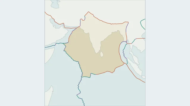
The Indian Plate contains the Indian subcontinent and neighbouring oceanic lithosphere. Its northern boundary lies within a much broader zone of mountain building and deformation.
India moves toward and beneath Eurasia along the Himalayan collision belt. The collision shortens and thickens the crust, with deformation extending into the Tibetan Plateau.
Some maps use one Indo-Australian Plate; PB2002 separates India and Australia. The transition is a broad deformation zone, so the chosen model affects how its outline is drawn.
Plate outlines use Peter Bird's PB2002 model, distributed by Nordpil under the Open Data Commons Attribution licence. Coastlines and country outlines are Natural Earth public-domain data. Boundary detail is limited by the source model.
Country lookup compares simplified land outlines with the plate model. Boundaries and historical coastlines are modelled features. This atlas explains geography; it does not predict earthquakes or provide site-specific hazard estimates.