Arabian Plate location
The Arabian Plate includes the Arabian Peninsula and adjoining areas. Its boundary follows geological structures rather than the borders of Saudi Arabia or other states.
Compare spreading beside Arabia with collision along its northeastern edge.
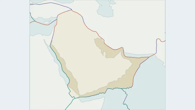
The Arabian Plate includes the Arabian Peninsula and adjoining areas. Its boundary follows geological structures rather than the borders of Saudi Arabia or other states.
The Red Sea separates Arabia from the African region through extension and spreading. The Gulf of Aden continues the separating system toward the Somali region.
To the northeast, Arabia converges with Eurasia along the Zagros collision belt. This compressional margin contrasts with the opening seas on the plate's other sides.
Plate outlines use Peter Bird's PB2002 model, distributed by Nordpil under the Open Data Commons Attribution licence. Coastlines and country outlines are Natural Earth public-domain data. Boundary detail is limited by the source model.
Country lookup compares simplified land outlines with the plate model. Boundaries and historical coastlines are modelled features. This atlas explains geography; it does not predict earthquakes or provide site-specific hazard estimates.