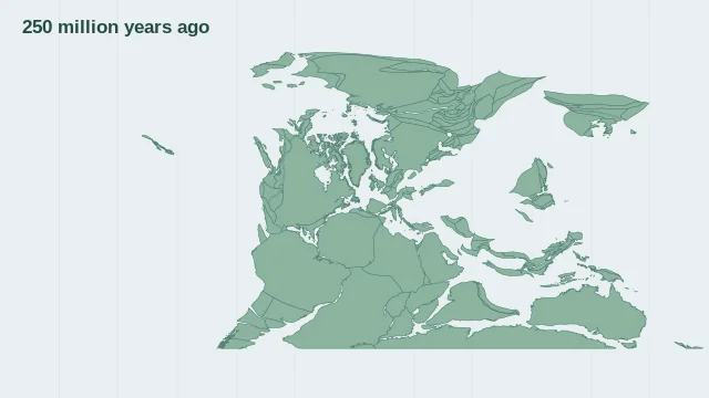
Pangea at the selected time
Pangea was a supercontinent assembled from landmasses that later separated. Its configuration changed through time, so a useful Pangea map needs a specific geological age. Choose one of six snapshots from the present to 250 million years ago. The display rotates modern coastline outlines with the MULLER2019 model; it does not reconstruct ancient shorelines or country borders.
Where modern regions were located
Modern region names provide orientation on an ancient reconstruction. Country borders did not exist then, and present-day coastlines are only a reference overlay unless reconstructed separately.
How Pangea broke apart
Rifting divided Pangea and opened new ocean basins, including the Atlantic. Breakup occurred in stages; today's continents did not all separate in a single event.
Questions about this map
Are Pangea and Pangaea different places?
No. They are alternative spellings for the same supercontinent.
Did modern countries exist on Pangea?
No. Modern country outlines can help identify present-day regions, but they are reference guides rather than ancient political geography.
Sources and map method
EarthByte / GPlates MULLER2019 reconstructions, mantle reference frame, CC BY 4.0. Six discrete snapshots rotate modern coastline outlines. They are not reconstructions of ancient shorelines.
Country lookup compares simplified land outlines with the plate model. Boundaries and historical coastlines are modelled features. This atlas explains geography; it does not predict earthquakes or provide site-specific hazard estimates.