Australia and surrounding ocean floor
The Australian Plate carries the Australian continent and extensive surrounding seafloor. A plate name identifies a geological region, not the limits of a country.
Compare Australia with its larger plate and the changing boundary processes around it.
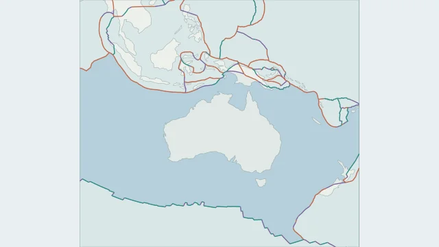
The Australian Plate carries the Australian continent and extensive surrounding seafloor. A plate name identifies a geological region, not the limits of a country.
North of Australia, convergence meets a complex network of island arcs and regional blocks around Indonesia and New Guinea. A single continental outline cannot describe that boundary.
New Zealand straddles the Australian-Pacific boundary. Pacific lithosphere descends near the North Island, while Australian lithosphere descends south of the country; the Alpine Fault connects contrasting segments.
Plate outlines use Peter Bird's PB2002 model, distributed by Nordpil under the Open Data Commons Attribution licence. Coastlines and country outlines are Natural Earth public-domain data. Boundary detail is limited by the source model.
Country lookup compares simplified land outlines with the plate model. Boundaries and historical coastlines are modelled features. This atlas explains geography; it does not predict earthquakes or provide site-specific hazard estimates.