The Australian and Pacific plates
New Zealand straddles two plates, with a broad boundary zone passing through and offshore from the country. Its islands cannot each be assigned neatly to one plate.
Follow the Australian-Pacific boundary as it changes character through New Zealand.
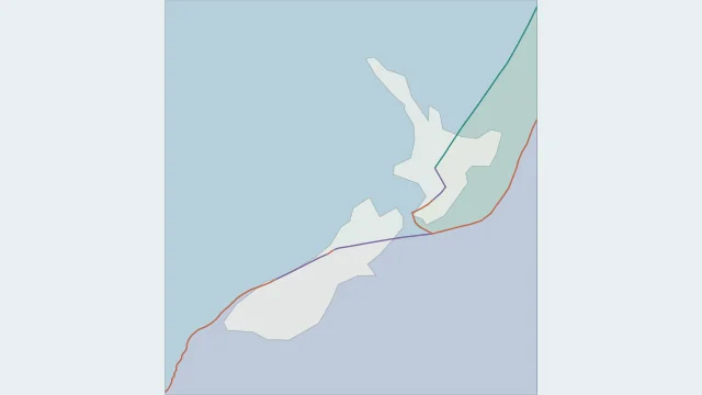
New Zealand straddles two plates, with a broad boundary zone passing through and offshore from the country. Its islands cannot each be assigned neatly to one plate.
The Alpine Fault accommodates substantial sideways motion and uplift in the South Island. The Marlborough faults connect it toward the subduction system to the northeast.
Pacific lithosphere descends beneath the Australian Plate at Hikurangi. South of New Zealand, Australian lithosphere descends beneath the Pacific Plate at Puysegur, reversing which plate is underneath.
Plate outlines use Peter Bird's PB2002 model, distributed by Nordpil under the Open Data Commons Attribution licence. Coastlines and country outlines are Natural Earth public-domain data. Boundary detail is limited by the source model. Terrain uses the Natural Earth I shaded-relief raster, public domain. Its global scale does not resolve individual faults or local elevation.
Country lookup compares simplified land outlines with the plate model. Boundaries and historical coastlines are modelled features. This atlas explains geography; it does not predict earthquakes or provide site-specific hazard estimates.