Major plates and regional blocks
Indonesia lies among the Australian, Indian, Pacific and Eurasian-related regions and many smaller blocks. Sunda, Banda Sea and neighbouring model regions help explain why one national outline spans several settings.
Compare the Sunda margin with the more complex plate network of eastern Indonesia.
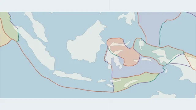
Indonesia lies among the Australian, Indian, Pacific and Eurasian-related regions and many smaller blocks. Sunda, Banda Sea and neighbouring model regions help explain why one national outline spans several settings.
Along Sumatra and Java, oceanic lithosphere descends beneath the Sunda region. Oblique convergence near Sumatra also produces major fault movement on land.
Volcanic arcs and earthquake depths help distinguish subduction from shallow crustal faulting. Eastern Indonesia adds collisions and opposing subduction systems, so the same pattern does not extend unchanged across every island.
Plate outlines use Peter Bird's PB2002 model, distributed by Nordpil under the Open Data Commons Attribution licence. Coastlines and country outlines are Natural Earth public-domain data. Boundary detail is limited by the source model. Terrain uses the Natural Earth I shaded-relief raster, public domain. Its global scale does not resolve individual faults or local elevation.
Country lookup compares simplified land outlines with the plate model. Boundaries and historical coastlines are modelled features. This atlas explains geography; it does not predict earthquakes or provide site-specific hazard estimates.