Sliding plate boundaries
Transform motion is mainly horizontal. It transfers movement along the plate network without creating a ridge of new crust or consuming a plate in a trench.
Follow boundaries where neighbouring plates move sideways past each other.
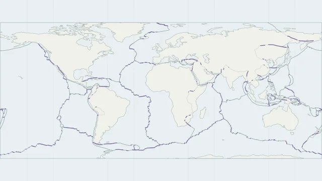
Transform motion is mainly horizontal. It transfers movement along the plate network without creating a ridge of new crust or consuming a plate in a trench.
Active oceanic transforms often link offset ridge segments. Fracture zones continue beyond them as older seafloor structures; the full length of a fracture zone is not an active plate boundary.
The San Andreas is a major part of the Pacific-North American boundary in California. Movement is shared across a wider fault system, including faults beyond the main San Andreas trace.
Plate outlines use Peter Bird's PB2002 model, distributed by Nordpil under the Open Data Commons Attribution licence. Coastlines and country outlines are Natural Earth public-domain data. Boundary detail is limited by the source model.
Country lookup compares simplified land outlines with the plate model. Boundaries and historical coastlines are modelled features. This atlas explains geography; it does not predict earthquakes or provide site-specific hazard estimates.