Faults versus plate boundaries
A fault is a fracture along which rock has moved. Some faults accommodate motion between plates; many others lie within plates or within a broad boundary zone.
Explore California's mapped Quaternary fault traces alongside the broader world plate-boundary network.
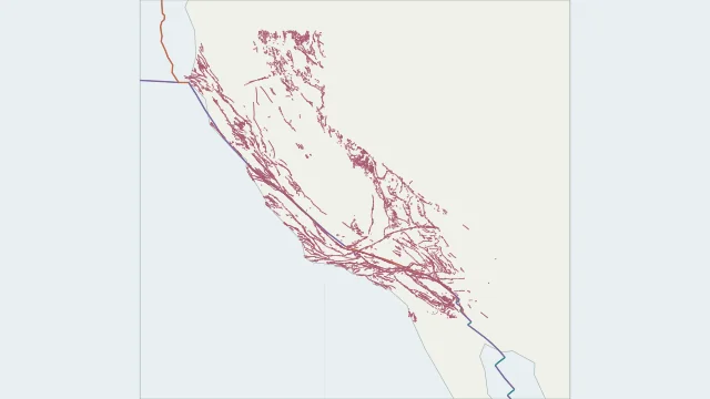
A fault is a fracture along which rock has moved. Some faults accommodate motion between plates; many others lie within plates or within a broad boundary zone.
The detailed layer uses the California part of the USGS Quaternary Fault and Fold Database, 2020 release. Click a trace for its recorded age and location certainty. It includes several Quaternary age classes, not only currently active faults; the separate offshore layer is not included.
A gap in mapped coverage does not establish that faults are absent. Check each source for its survey area, publication date and definition of activity before comparing regions.
No. A plate boundary may include several faults, a spreading ridge, a trench or a wide deformation zone.
Plate outlines use Peter Bird's PB2002 model, distributed by Nordpil under the Open Data Commons Attribution licence. Coastlines and country outlines are Natural Earth public-domain data. Boundary detail is limited by the source model. Detailed California traces use the USGS Quaternary Fault and Fold Database, 2020 release. The separate offshore layer is omitted.
Country lookup compares simplified land outlines with the plate model. Boundaries and historical coastlines are modelled features. This atlas explains geography; it does not predict earthquakes or provide site-specific hazard estimates.