The plate beneath the Atlantic
The South American Plate reaches east from the continent across ocean floor to the Mid-Atlantic Ridge. Brazil's coast is a land-water boundary within the plate.
Compare the South American continent with its plate extending into the Atlantic.
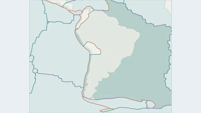
The South American Plate reaches east from the continent across ocean floor to the Mid-Atlantic Ridge. Brazil's coast is a land-water boundary within the plate.
Along much of the western margin, the Nazca Plate sinks beneath South America. This convergence helps build the Andes and produces earthquakes at a range of depths.
The Mid-Atlantic Ridge separates the South American and African plate regions. Follow the ridge rather than the shore to find this active plate edge.
Plate outlines use Peter Bird's PB2002 model, distributed by Nordpil under the Open Data Commons Attribution licence. Coastlines and country outlines are Natural Earth public-domain data. Boundary detail is limited by the source model.
Country lookup compares simplified land outlines with the plate model. Boundaries and historical coastlines are modelled features. This atlas explains geography; it does not predict earthquakes or provide site-specific hazard estimates.