The Mid-Atlantic Ridge
The Mid-Atlantic Ridge separates North America from Eurasia in the north and South America from Africa farther south. Its path is broken into segments joined by transforms.
Follow the oceanic spreading system and compare its ridges with the surrounding seafloor.
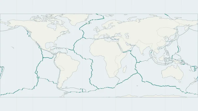
The Mid-Atlantic Ridge separates North America from Eurasia in the north and South America from Africa farther south. Its path is broken into segments joined by transforms.
The East Pacific Rise and the Indian Ocean ridges form other major spreading systems. Their relief and spreading rates differ; a ridge is not necessarily the geographical middle of an ocean.
Oceanic crust is youngest near an active spreading axis and generally older farther away. Age bands, offsets and missing crust preserve a more complicated history than distance alone.
Plate outlines use Peter Bird's PB2002 model, distributed by Nordpil under the Open Data Commons Attribution licence. Coastlines and country outlines are Natural Earth public-domain data. Boundary detail is limited by the source model.
Country lookup compares simplified land outlines with the plate model. Boundaries and historical coastlines are modelled features. This atlas explains geography; it does not predict earthquakes or provide site-specific hazard estimates.