Where the Nazca Plate lies
The Nazca Plate is mainly oceanic lithosphere west of South America. Its name does not describe a country or the entire southeastern Pacific Ocean.
Locate the Nazca Plate between the East Pacific Rise and South America.
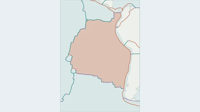
The Nazca Plate is mainly oceanic lithosphere west of South America. Its name does not describe a country or the entire southeastern Pacific Ocean.
Its eastern margin descends beneath South America at the Peru-Chile trench system. Earthquakes deeper below the continent help trace the slab beyond its surface entry.
Spreading boundaries connect it with the Pacific, Cocos and Antarctic regions. Smaller plate regions occur around some ridge junctions in more detailed models.
Plate outlines use Peter Bird's PB2002 model, distributed by Nordpil under the Open Data Commons Attribution licence. Coastlines and country outlines are Natural Earth public-domain data. Boundary detail is limited by the source model.
Country lookup compares simplified land outlines with the plate model. Boundaries and historical coastlines are modelled features. This atlas explains geography; it does not predict earthquakes or provide site-specific hazard estimates.