Somali Plate extent
The Somali Plate includes eastern Africa and adjoining Indian Ocean lithosphere. Madagascar lies within this plate region, but the plate extends much farther offshore.
Follow the Somali Plate through East Africa and into the Indian Ocean.
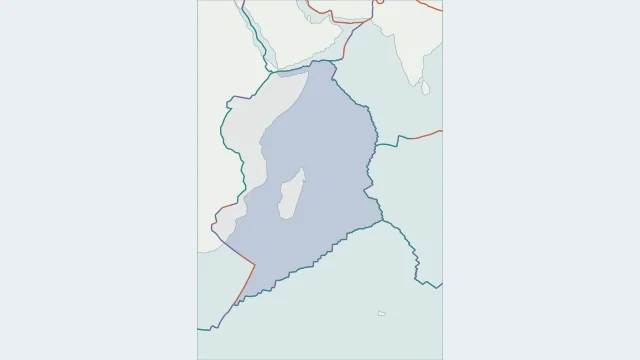
The Somali Plate includes eastern Africa and adjoining Indian Ocean lithosphere. Madagascar lies within this plate region, but the plate extends much farther offshore.
The western boundary follows the broad East African Rift system. Its multiple branches and smaller blocks make a detailed regional map more informative than a single straight dividing line.
PB2002 labels this region Somalia. Somali and Somalian both occur in geological sources; Nubian commonly names the African region to its west when the two are treated separately.
Plate outlines use Peter Bird's PB2002 model, distributed by Nordpil under the Open Data Commons Attribution licence. Coastlines and country outlines are Natural Earth public-domain data. Boundary detail is limited by the source model.
Country lookup compares simplified land outlines with the plate model. Boundaries and historical coastlines are modelled features. This atlas explains geography; it does not predict earthquakes or provide site-specific hazard estimates.