Mid-ocean ridges
At a spreading ridge, plates move apart and new oceanic crust forms. The Mid-Atlantic Ridge and East Pacific Rise are large examples, but they are parts of a connected, segmented system.
Locate spreading ridges in the oceans and rift zones within continents.
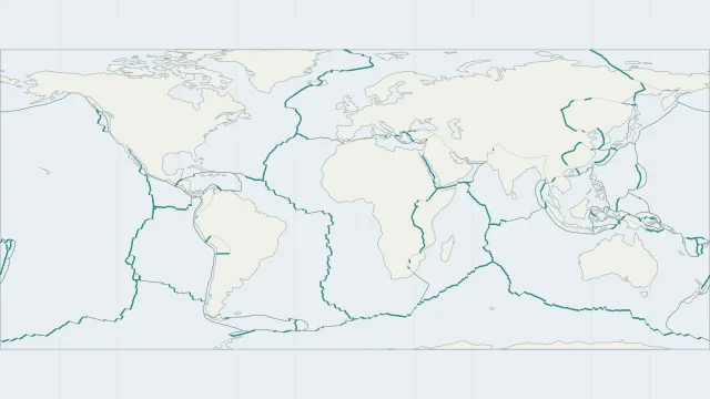
At a spreading ridge, plates move apart and new oceanic crust forms. The Mid-Atlantic Ridge and East Pacific Rise are large examples, but they are parts of a connected, segmented system.
Continental rifting stretches and thins existing continental crust. The East African Rift is an example; its valleys and faults do not yet form one continuous new ocean.
Iceland exposes parts of an oceanic spreading system on land. East Africa instead shows continental rifting, so similar separating motion occurs in different crustal settings.
Plate outlines use Peter Bird's PB2002 model, distributed by Nordpil under the Open Data Commons Attribution licence. Coastlines and country outlines are Natural Earth public-domain data. Boundary detail is limited by the source model.
Country lookup compares simplified land outlines with the plate model. Boundaries and historical coastlines are modelled features. This atlas explains geography; it does not predict earthquakes or provide site-specific hazard estimates.