African Plate terminology
In PB2002, Africa and Somalia are separate regions. The western African region is often called the Nubian Plate in regional research; a broad classroom label of African Plate may combine both.
Compare the African plate region with the Somali Plate and the East African Rift.
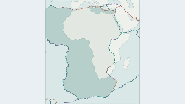
In PB2002, Africa and Somalia are separate regions. The western African region is often called the Nubian Plate in regional research; a broad classroom label of African Plate may combine both.
The East African Rift separates the Nubian and Somali regions through a wide, branching deformation zone. Smaller blocks occur within the system, so it is more complex than one clean crack.
African plate boundaries include Atlantic spreading ridges, the Red Sea system and convergence toward the Mediterranean. These edges extend far beyond the outline of the African continent.
Plate outlines use Peter Bird's PB2002 model, distributed by Nordpil under the Open Data Commons Attribution licence. Coastlines and country outlines are Natural Earth public-domain data. Boundary detail is limited by the source model.
Country lookup compares simplified land outlines with the plate model. Boundaries and historical coastlines are modelled features. This atlas explains geography; it does not predict earthquakes or provide site-specific hazard estimates.