Countries around the Ring of Fire
The Ring of Fire connects regions around the Pacific, including western South America, Central America, Alaska, Japan and New Zealand. It describes a geological belt, not the borders of those countries.
Follow the earthquake and volcanic belts around the margins of the Pacific Ocean.
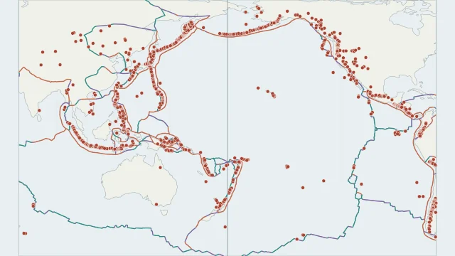
The Ring of Fire connects regions around the Pacific, including western South America, Central America, Alaska, Japan and New Zealand. It describes a geological belt, not the borders of those countries.
Subduction links many of its trenches, deep earthquakes and volcanic arcs. Local patterns differ, and some stretches are dominated by sideways fault movement rather than an arc of volcanoes.
The belt involves the Pacific Plate and several other plates, including Nazca, Cocos and the Philippine Sea Plate. Its outline cannot be replaced by the Pacific Plate polygon.
Plate outlines use Peter Bird's PB2002 model, distributed by Nordpil under the Open Data Commons Attribution licence. Coastlines and country outlines are Natural Earth public-domain data. Boundary detail is limited by the source model. Volcano locations use the NOAA NCEI catalogue, originating from Smithsonian GVP. The layer describes locations and historical evidence, not current eruptions.
Country lookup compares simplified land outlines with the plate model. Boundaries and historical coastlines are modelled features. This atlas explains geography; it does not predict earthquakes or provide site-specific hazard estimates.