Where plates descend
A trench locates the seafloor edge of a subduction system. The slab is the plate that continues down into the mantle. Slab geometry varies along each margin.
Compare the surface trenches and deeper earthquake patterns of descending plates.
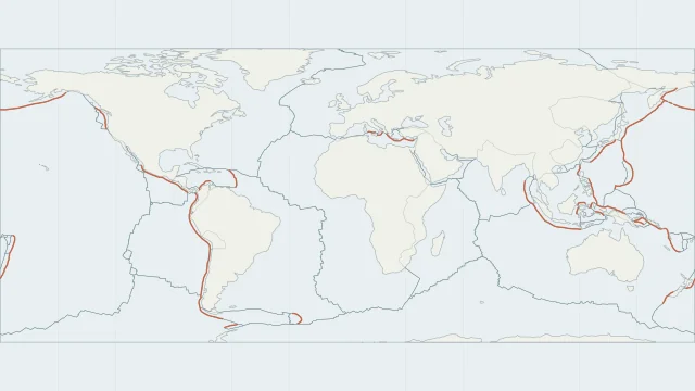
A trench locates the seafloor edge of a subduction system. The slab is the plate that continues down into the mantle. Slab geometry varies along each margin.
Earthquake depth adds a third dimension to the map. A band of progressively deeper events can help trace a descending slab, although individual earthquakes do not define its whole surface.
Nazca lithosphere descends beneath South America. Around Japan, both the Pacific and Philippine Sea plates subduct, along different margins and beneath different regional plate blocks.
Plate outlines use Peter Bird's PB2002 model, distributed by Nordpil under the Open Data Commons Attribution licence. Coastlines and country outlines are Natural Earth public-domain data. Boundary detail is limited by the source model.
Country lookup compares simplified land outlines with the plate model. Boundaries and historical coastlines are modelled features. This atlas explains geography; it does not predict earthquakes or provide site-specific hazard estimates.