Subduction versus collision
Subduction carries one plate beneath another. Continental collision thickens and deforms buoyant continental crust. Both involve convergence, but their surface features and structures differ.
Compare plate convergence at subduction zones and continental collision belts.
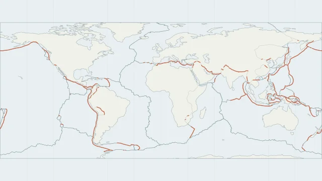
Subduction carries one plate beneath another. Continental collision thickens and deforms buoyant continental crust. Both involve convergence, but their surface features and structures differ.
A deep ocean trench often marks the surface entry to a subduction zone. The descending slab extends far below and inland from that line, so its full shape needs a cross-section.
The Andes lie above subducting Nazca lithosphere. The Himalayas record the collision of India with Eurasia, offering a useful comparison between an oceanic margin and a continental collision.
Plate outlines use Peter Bird's PB2002 model, distributed by Nordpil under the Open Data Commons Attribution licence. Coastlines and country outlines are Natural Earth public-domain data. Boundary detail is limited by the source model.
Country lookup compares simplified land outlines with the plate model. Boundaries and historical coastlines are modelled features. This atlas explains geography; it does not predict earthquakes or provide site-specific hazard estimates.