Plates around Japan
The Pacific and Philippine Sea plates meet the upper-plate regions around Japan. PB2002 distinguishes Okhotsk and Amur, where simplified maps may instead show North American and Eurasian labels.
Compare Japan's trenches, surrounding plate regions and earthquake depths.
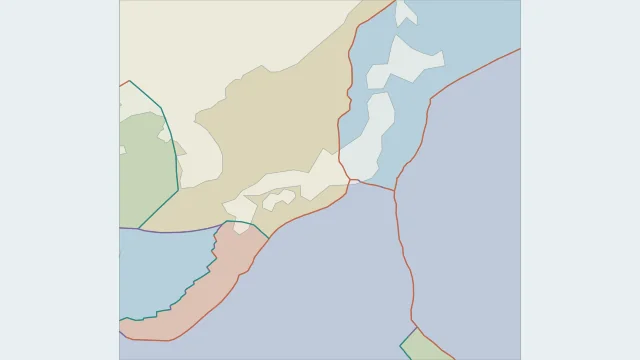
The Pacific and Philippine Sea plates meet the upper-plate regions around Japan. PB2002 distinguishes Okhotsk and Amur, where simplified maps may instead show North American and Eurasian labels.
The Pacific Plate descends at the Japan Trench off northeastern Honshu. The Philippine Sea Plate descends at the Nankai Trough off southwestern Japan, so these are different subduction systems.
Earthquakes can occur within the upper plate, on the plate interface or inside a descending slab. Depth helps separate these settings; a surface point alone cannot identify the fault.
No. Japan spans a complex meeting of plate regions. The exact names and smaller block boundaries depend on the scientific model.
Plate outlines use Peter Bird's PB2002 model, distributed by Nordpil under the Open Data Commons Attribution licence. Coastlines and country outlines are Natural Earth public-domain data. Boundary detail is limited by the source model. Terrain uses the Natural Earth I shaded-relief raster, public domain. Its global scale does not resolve individual faults or local elevation.
Country lookup compares simplified land outlines with the plate model. Boundaries and historical coastlines are modelled features. This atlas explains geography; it does not predict earthquakes or provide site-specific hazard estimates.