The Caribbean Plate outline
The Caribbean Plate lies between the larger North and South American regions and extends toward Central America. Caribbean geography includes islands on different sides of these boundaries.
Explore the Caribbean Plate and the different boundaries around its edges.
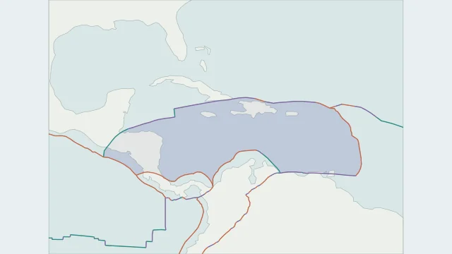
The Caribbean Plate lies between the larger North and South American regions and extends toward Central America. Caribbean geography includes islands on different sides of these boundaries.
Subduction occurs along the Lesser Antilles and the Central American margin. Northern and southern edges include major sideways fault systems, making the perimeter varied rather than one continuous trench.
Cocos lithosphere descends beneath the Caribbean region from the Pacific side. Smaller blocks around Panama and northern South America add detail beyond a simplified Caribbean outline.
Plate outlines use Peter Bird's PB2002 model, distributed by Nordpil under the Open Data Commons Attribution licence. Coastlines and country outlines are Natural Earth public-domain data. Boundary detail is limited by the source model.
Country lookup compares simplified land outlines with the plate model. Boundaries and historical coastlines are modelled features. This atlas explains geography; it does not predict earthquakes or provide site-specific hazard estimates.