Identify the major plates
Start with a continent or ocean you recognise, then inspect the entire plate outline. Remember that the named continent may occupy only part of the plate.
Practise recognising tectonic plates by their shapes, locations and neighbours.
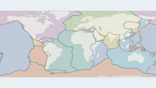
IDENTIFY THE PLATE
Identify the highlighted region, then choose its name below.
Start with a continent or ocean you recognise, then inspect the entire plate outline. Remember that the named continent may occupy only part of the plate.
For each plate, identify one place where it separates from, converges with or slides past a neighbour. These relationships make the outline easier to remember.
When an answer surprises you, compare the model labels rather than assuming a country occupies one plate. India-Australia and Africa-Somalia are useful examples of how map conventions differ.
Plate outlines use Peter Bird's PB2002 model, distributed by Nordpil under the Open Data Commons Attribution licence. Coastlines and country outlines are Natural Earth public-domain data. Boundary detail is limited by the source model.
Country lookup compares simplified land outlines with the plate model. Boundaries and historical coastlines are modelled features. This atlas explains geography; it does not predict earthquakes or provide site-specific hazard estimates.